Start Point

Naturpark Info Center Scharnitz (P2)

End Point

Naturpark Info Center Scharnitz (P2)

Difficulty

Medium

Total Distance

8,60 km

Descent Meters

212 m

Highest Point

1074 m

Total Time

02:45 h

Map & Elevation Profile

Start Point

Naturpark Info Center Scharnitz (P2)

End Point

Naturpark Info Center Scharnitz (P2)

Difficulty

Medium

Total Distance

8,60 km

Descent Meters

212 m

Highest Point

1074 m

Total Time

02:45 h

Hiking

Best Time

Jan

Feb

Mar

Apr

May

Jun

Jul

Aug

Sep

Oct

Nov

Dec

Hiking tour

Circular hike

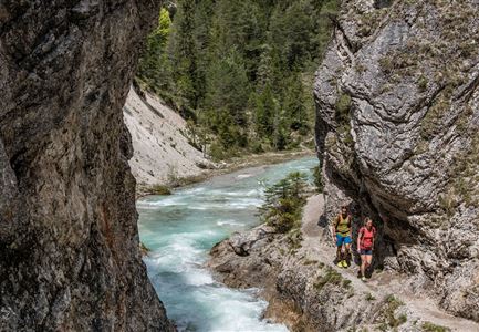
The hike into the picturesque Hinterautal valley begins at the Nature Park Info Center Scharnitz, located directly at Parking Lot P2 on Hinterautalstraße. At the start, follow the road for about 500 meters into the valley before the trail branches off to the right onto the Isarsteig. This narrow path meanders idyllically along the Isar and eventually leads to the end of the trail, where it joins the Nederweg.

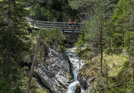
From here, continue straight ahead: the trail passes the charming Scharnitzer Alm, which blends beautifully into the alpine landscape, and leads directly to the entrance of the impressive Gleirschklamm. Opposite the gorge entrance, a well-marked trail ascends to the left towards the Gleirschhöhe. From there, you can enjoy a stunning view of the surrounding mountain scenery.

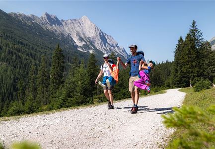
The descent follows a forestry road, where you head left down the valley. This pleasant path gently takes you back to the starting point at the Karwendel parking lot, where the hike concludes on a delightful note.

Features & Characteristics

Start Point

Naturpark Info Center Scharnitz (P2)

End Point

Naturpark Info Center Scharnitz (P2)

Loop tour

Yes
Similar Tour Suggestions

Blick auf das Wettersteingebirge mit Neuleutasch im Sommer - Luftaufnahme.jpg

Hiking

Circular hike from Seefeld to Gießenbach & Leutasch

Length

21,50 km

Duration

06:30 h

Uphill

773 hm

Downhill

815 hm

Altitude

1616 hm

Difficulty

Medium

Durch die Gleirschklamm bei Scharnitz.jpg

Hiking

Circular hiking trail Gleirschklamm Gorge

Length

13,10 km

Duration

04:00 h

Uphill

416 hm

Downhill

410 hm

Altitude

1152 hm

Difficulty

Medium

Wanderung zur Wettersteinhütte im Sommer_Blick auf Wangalm bei Sonnenaufgangsstimmung_Weitwinkel.jpg

Hiking

Gaistal Valley Alpine Pasture Circular Hike

Length

10,50 km

Duration

04:15 h

Uphill

600 hm

Altitude

1759 hm

Difficulty

Medium

Gleirschklamm - Scharnitz (17).jpg

Hiking

Hike through the Gleirschklamm to the Möslalm

Length

21,20 km

Duration

06:30 h

Uphill

505 hm

Downhill

498 hm

Altitude

1261 hm

Difficulty

Medium

Familien-Weitwanderung im Gaistal - Familie spielt Engelchen.jpg

Hiking

Stage 3: To Hämmermoosalm & Wrap Up – Leutasch 3-Day Hut Hike for Families

Length

6,50 km

Uphill

10 hm

Downhill

840 hm

Altitude

2132 hm

Difficulty

Medium

Wildmoosalm im Sommer - Alm aus der Distanz mit Gewässer im Vordergrund.jpg

Hiking

Circular hiking trail Wildmoos-Hochmoos

Length

10,00 km

Duration

04:00 h

Uphill

437 hm

Altitude

1544 hm

Difficulty

Medium

Bike Tour durchs Karwendeltal aufs Karwendelhaus - Scharnitz (13).jpg

Hiking

Bike & Hike Kristenalm

Length

25,00 km

Duration

04:00 h

Uphill

420 hm

Altitude

1249 hm

Difficulty

Medium

Rauthhütte in Leutasch

Hiking

Circular hiking to Rauthhütte alpine hut & Inntal Valley view

Length

6,20 km

Duration

03:00 h

Uphill

439 hm

Altitude

1599 hm

Difficulty

Medium